ISRO-NASA's NISAR Satellite Launch: A Milestone in Earth Observation
ISRO, in collaboration with NASA, launched the NISAR satellite from Sriharikota aboard a GSLV rocket. The mission, costing over USD 1.5 billion, aims to provide high-resolution images of Earth's surfaces. NISAR, a unique dual-band radar satellite, promises open-source data access, benefiting global scientific research.
- Country:
- India
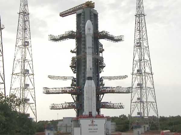
The Indian Space Research Organisation, in partnership with NASA, successfully launched the NISAR satellite, an advanced Earth observation satellite, on Wednesday evening from Sriharikota. The launch took place at the scheduled time from the Satish Dhawan Space Centre on India's southeastern coast, using an ISRO Geosynchronous Satellite Launch Vehicle (GSLV) rocket at 5:40 PM.
The mission, a decade in the making, represents a joint financial commitment exceeding USD 1.5 billion. For the first time, an ISRO GSLV rocket was used to place a satellite into a Sun-Synchronous Polar Orbit, instead of the usual PSLV. The milestone was celebrated with ISRO posting 'Liftoff, and we have liftoff! GSLV-F16 has successfully launched with NISAR onboard' on social media.
The 2,392 kg NISAR satellite will orbit the Earth every 97 minutes, capturing images of land, ice, and ocean surfaces every 12 days for a five-year mission duration. The cutting-edge mission, equipped with a dual-band Synthetic Aperture Radar, offers high-resolution imaging and open-source data accessibility, promoting global scientific collaboration.
(With inputs from agencies.)


