Future of climate-resilient agriculture with GIS, AI, and remote sensing
GIS enables spatial mapping of climate vulnerability, helping policymakers and researchers visualize hazard zones and plan targeted interventions. It supports complex simulations of land-use change and models that assess how various climate scenarios could impact specific agricultural regions.
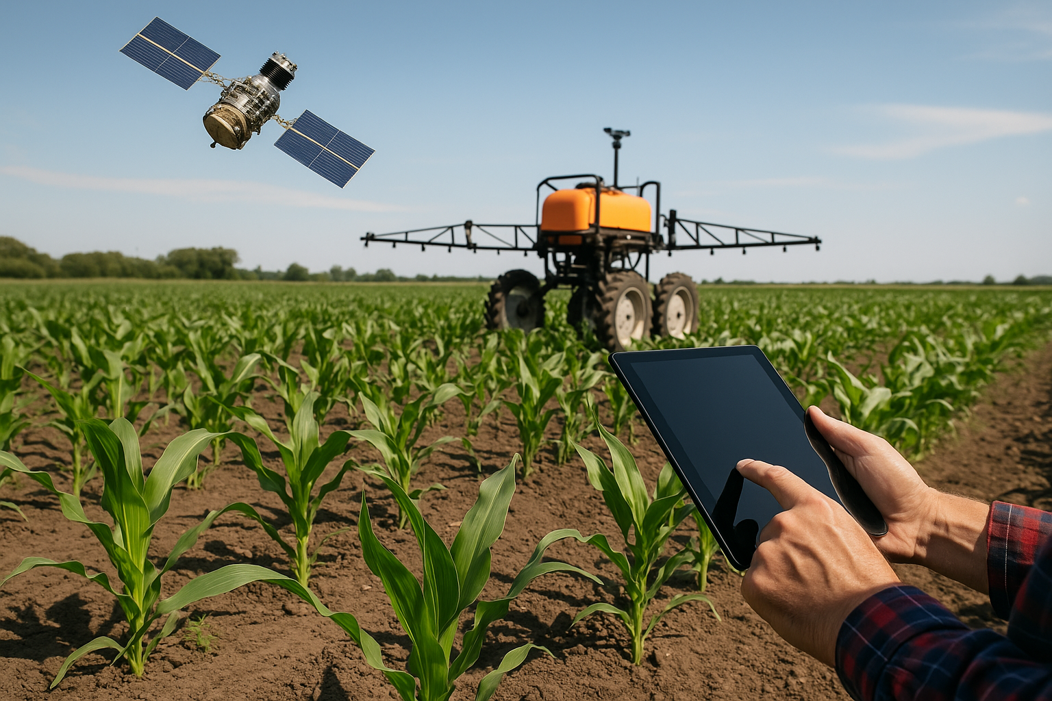
A new research review examines how emerging digital tools, including Geographic Information Systems (GIS), Remote Sensing (RS), and Artificial Intelligence (AI), are transforming the agricultural sector’s response to climate change.
Published in the peer-reviewed journal AgriEngineering, the study titled "Individual and Synergistic Contributions of GIS, Remote Sensing, and AI in Advancing Climate-Resilient Agriculture" explores how these technologies contribute individually and in combination to building resilience in farming systems. It introduces a novel framework for Climate-Resilient Agriculture (CRA), structured around three core pillars: climate risk adaptation, sustainable resource use, and resilient agricultural production.
How can GIS, remote sensing, and AI support climate risk adaptation?
With increasing droughts, floods, and temperature extremes, agriculture requires precise data to identify and manage climate risks. The study begins by analyzing the distinctive role of each digital tool in this context.
GIS enables spatial mapping of climate vulnerability, helping policymakers and researchers visualize hazard zones and plan targeted interventions. It supports complex simulations of land-use change and models that assess how various climate scenarios could impact specific agricultural regions.
Remote Sensing, using satellite and airborne sensors, provides dynamic, real-time insights into landscape and vegetation changes. It tracks variables like canopy cover, soil moisture, and temperature anomalies, making it indispensable for early warning systems. However, its accuracy depends on atmospheric conditions, sensor resolution, and preprocessing algorithms.
Artificial Intelligence offers a powerful capability for forecasting and classification. Machine learning models can detect subtle patterns in climatic and agronomic data, enabling predictive analysis of drought likelihood, crop stress, and long-term productivity shifts. However, these models require extensive training data and validation.
While each tool has limitations, the study emphasizes their complementary potential when used together. For instance, AI can enhance remote sensing outputs by filtering noise and improving classification accuracy, while GIS provides the spatial context necessary to translate predictions into policy decisions.
What is the role of these technologies in sustainable resource management?
The second major question addressed by the research concerns resource efficiency, especially water and soil conservation - two areas where digital technologies can deliver substantial impact.
GIS platforms allow precise mapping of irrigation zones, soil degradation risks, and fertilizer distribution, promoting sustainable land management. These insights can optimize decisions around land use and crop rotation, which are essential in water-scarce environments.
Remote Sensing technologies monitor evapotranspiration, surface temperature, and water stress at scale. This enables farmers and planners to assess irrigation efficiency and determine which areas require intervention without deploying extensive ground sensors.
AI plays a critical role in generating resource efficiency insights from vast and disparate datasets. Algorithms can analyze historical weather records, crop responses, and soil profiles to recommend site-specific management practices. AI-driven decision support systems can, for example, optimize water use by integrating forecast models with crop demand estimates.
The study finds that combining RS and AI can significantly enhance the accuracy and reliability of water and nutrient management decisions. When layered onto GIS frameworks, this combination allows for spatially explicit precision agriculture that is both data-driven and climate-adaptive.
How do these technologies advance resilient agricultural production?
The final dimension explored is the ability of digital technologies to sustain and even improve agricultural productivity under climate stress.
GIS contributes through land suitability mapping and agricultural zoning, ensuring crops are grown in optimal microclimates. It supports adaptive cropping strategies that take future climate projections into account.
Remote Sensing enables continuous crop monitoring, allowing for detection of pests, diseases, and yield anomalies early in the season. This facilitates timely interventions that reduce losses and improve output quality.
AI is increasingly being used for yield prediction and crop health diagnostics. Convolutional neural networks and other deep learning methods can analyze visual data to assess crop vigor and forecast harvest outcomes. Additionally, reinforcement learning algorithms are being tested for autonomous farm machinery and adaptive irrigation systems.
The true potential for advancing resilient agriculture lies in the integration of all three technologies. A decision support matrix introduced in the research outlines how each tool, or combinations thereof, can be deployed to meet specific climate adaptation and productivity goals. This matrix serves as a practical guide for governments, agri-tech firms, and development organizations aiming to invest in digital agriculture.
Toward a digitally enabled climate-resilient future
This research not only fills a critical gap in literature by disentangling the overlapping roles of GIS and Remote Sensing, but it also highlights the untapped synergistic potential of combining all three technologies. Rather than working in silos, the authors argue that the future of digital agriculture lies in interoperable systems that integrate spatial intelligence, temporal monitoring, and predictive modeling.
The greatest challenge, the study asserts, is not technical capability, but ensuring accessibility, local capacity, and infrastructure to implement these tools in diverse farming contexts. Data availability, system transparency, and farmer engagement will ultimately determine how effectively these technologies are adopted.
- READ MORE ON:
- climate-resilient agriculture
- GIS in agriculture
- AI in precision agriculture
- sustainable farming innovations
- agricultural climate adaptation tools
- how AI improves climate-resilient agriculture
- role of remote sensing in drought detection
- digital tools for climate-smart agriculture
- smart agriculture research 2025
- best tools for climate adaptation in agriculture
- FIRST PUBLISHED IN:
- Devdiscourse


