GIS transforms global fight against toxic water pollution
Heavy metals originate from multiple pathways: untreated industrial effluents, such as those from tanneries and mining operations; agricultural runoff rich in pesticides and fertilizers; municipal waste mismanagement; and vehicle emissions in urban corridors. In Bangladesh, for example, around 20,000 cubic meters of untreated tannery effluent were discharged daily into the Buriganga River until recent relocation efforts.
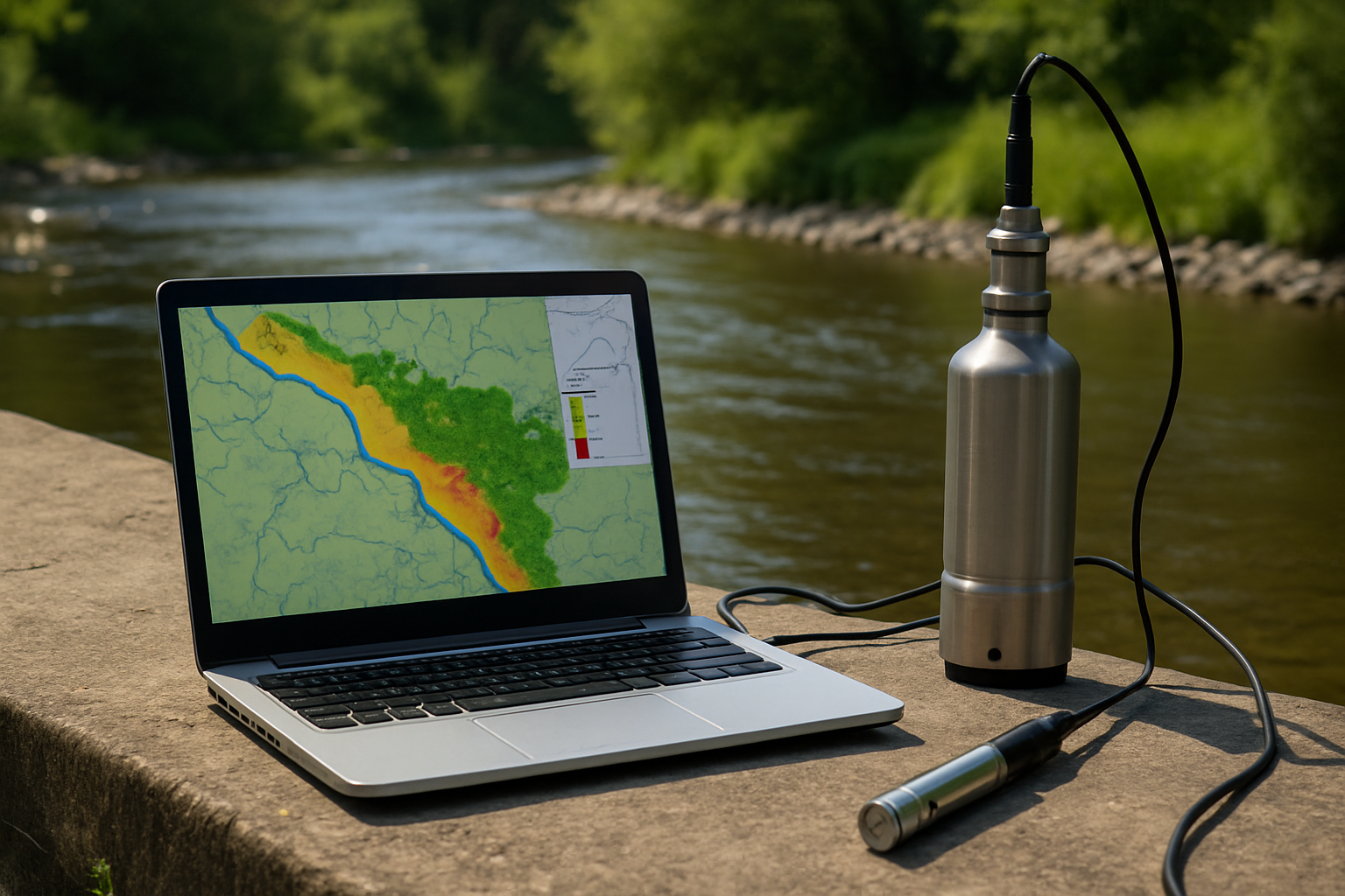
A new scientific review published in Applied Sciences highlights the expanding role of geographic information systems (GIS) in identifying, monitoring, and managing heavy metal contamination in global water resources. The research provides one of the most comprehensive assessments of how GIS techniques are being applied to water pollution challenges linked to industry, urbanization, and agriculture.
The study, titled “GIS Applications in Monitoring and Managing Heavy Metal Contamination of Water Resources”, combines a systematic review with bibliometric analysis to examine nearly 600 research papers. The findings confirm that GIS is no longer a passive mapping tool but has become a decision-support framework for predicting contamination risks, tracing pollution sources, and safeguarding public health.
How widespread is heavy metal water contamination?
Heavy metals such as cadmium, chromium, copper, manganese, mercury, and nickel often exceed World Health Organization limits in many regions. The highest concentrations are typically linked to industrialized and densely populated areas in South Asia, North Africa, and parts of Eastern Europe.
The study highlights case examples where chromium contamination in Aligarh, mercury pollution in the Pearl River Estuary, and cadmium levels in regions of South Asia far surpassed international safety thresholds. These findings reflect a broader global trend in which rapid industrial growth, coupled with limited wastewater treatment, continues to overload freshwater systems.
Besides specific hotspots, the review makes clear that the problem is systemic. Heavy metals originate from multiple pathways: untreated industrial effluents, such as those from tanneries and mining operations; agricultural runoff rich in pesticides and fertilizers; municipal waste mismanagement; and vehicle emissions in urban corridors. In Bangladesh, for example, around 20,000 cubic meters of untreated tannery effluent were discharged daily into the Buriganga River until recent relocation efforts.
By integrating monitoring data with GIS, researchers and authorities are now able to pinpoint geographic clusters of contamination, revealing how environmental pressures accumulate within watersheds and groundwater reserves.
What role does GIS play in managing the crisis?
The study positions GIS as more than a mapping system - it is a diagnostic and predictive instrument that enables both researchers and policymakers to understand contamination dynamics. The review catalogues an array of GIS-based methods already in use.
Among the most frequently applied techniques are interpolation methods such as Inverse Distance Weighting, which help visualize contamination spread across unmonitored areas. More sophisticated models integrate GIS with hydrological tools like MONERIS to estimate heavy metal inputs into river basins, or SWMM to simulate stormwater runoff carrying metals into urban streams. Groundwater vulnerability is assessed using modified DRASTIC models, while multi-criteria decision analysis combined with analytic hierarchy processes helps compare contamination risks in different settings.
Machine learning approaches are also being adopted. Artificial neural networks have been used to predict arsenic contamination, while fuzzy water quality indices allow for more nuanced assessments of pollution levels. These integrations underscore that GIS is increasingly combined with advanced analytics, creating hybrid systems capable of both visualization and forecasting.
According to the study, GIS contributes to public health by linking contamination data to exposure risks. Mapping hazard quotients and cancer risk probabilities at neighborhood or watershed scales enables more targeted interventions. This functionality has particular value in developing regions, where resources for broad monitoring are scarce but localized risk maps can guide immediate action.
What challenges remain in applying GIS effectively?
While the study celebrates the growth of GIS applications, it also identifies significant limitations. First, the authors note that the systematic review itself was constrained by the narrow use of a single search phrase. This raises the risk of omitting relevant studies that describe water contamination with different terminology.
Next up, many of the studies analyzed rely on World Health Organization standards from 2008. Since many national and international bodies have updated guidelines since then, exceedance assessments may not reflect current thresholds. This limits comparability and underscores the need for harmonized standards across regions.
Third, the paper highlights persistent issues with data quality and scale. Monitoring networks are unevenly distributed worldwide, with high-density data in some countries and critical gaps in others. Sampling and laboratory methods also vary widely, creating challenges in cross-study synthesis. The authors caution that these gaps can reduce the reliability of predictive models, especially when data is extrapolated across large areas.
Lastly, the integration of GIS into governance is not uniform. While some countries have embraced GIS as part of water resource management and environmental policy, others lack the institutional capacity or technical expertise to make full use of the technology. This imbalance risks widening the gap between well-resourced regions and those already most vulnerable to contamination.
- FIRST PUBLISHED IN:
- Devdiscourse


