SVAMITVA Scheme & Geospatial Policy Transform Land Governance in India: Dr. Jitendra Singh
Dr. Singh praised the National Geospatial Policy 2022 as a transformative step that has democratized access to geospatial data, making it widely available for both government use and public benefit.
- Country:
- India
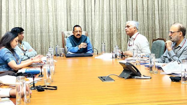
Union Minister of State (Independent Charge) for Science & Technology, Dr. Jitendra Singh, has hailed the SVAMITVA Scheme as a landmark initiative in citizen empowerment, transforming rural land governance and setting a global benchmark for citizen-centric governance. Speaking at a high-level review meeting of the Survey of India at the Parliament House, the Minister said the scheme has ended decades of dependence on revenue officials and patwaris by giving citizens the tools to self-map their land holdings.
The SVAMITVA initiative, which stands for Survey Village and Mapping with Improvised Technology in Village Areas, enables rural landowners to receive accurate property records, reducing disputes and ensuring secure ownership rights. Dr. Singh noted that the success of the scheme has inspired other countries to consider adopting similar models, underscoring India’s leadership in digital and geospatial governance.
National Geospatial Policy 2022 – A Game Changer
Dr. Singh praised the National Geospatial Policy 2022 as a transformative step that has democratized access to geospatial data, making it widely available for both government use and public benefit. This policy shift has unlocked new opportunities in urban planning, infrastructure development, environmental management, and digital services.
A key milestone highlighted during the meeting was the harmonization of boundaries in collaboration with the Registrar General of India, streamlining administrative mapping across states and districts.
Expanding Technological Capabilities
The Survey of India’s expertise is now integral to several flagship government programmes, including:
-
SVAMITVA Scheme – Rural property mapping and ownership rights.
-
AMRUT Mission – Urban renewal and transformation.
-
Smart Cities Mission – Data-driven urban planning.
-
Digital Twin Mission – Creating digital replicas of physical assets for planning and simulation.
-
NAKSHA Scheme – Standardized mapping framework.
Plans are underway to integrate Artificial Intelligence (AI) and Machine Learning (ML) into surveying operations, enhancing precision, efficiency, and real-time data analysis. The Survey of India will also expand collaborations with other government departments to fully leverage its world-class facilities.
From Map Production to Geospatial Enablement
Dr. Singh emphasized that the Survey of India is transitioning from being a traditional map producer to a geospatial enabler for multiple sectors of the economy. The organization has developed high-accuracy Digital Elevation Models (DEMs) and established Continuously Operating Reference Stations (CORS), which are now part of a National Geodetic Reference Framework (NGRF).
With 478 CORS stations already operational, these facilities will significantly improve the accuracy of mapping and navigation services. The creation of Geodetic Asset Registers at state, district, and taluka levels will make crucial surveying resources available to Tehsildars, aiding in citizen service delivery such as land record verification and infrastructure planning.
Global Collaborations and Future Roadmap
Dr. Singh highlighted Prime Minister Narendra Modi’s role in facilitating bilateral MoUs with Russia and Nigeria in geospatial data sharing and surveying. Six more international collaborations are currently in progress, expanding India’s role in the global geospatial technology ecosystem.
Looking ahead, the Survey of India plans to complete high-resolution mapping of the country by 2030, with 5–10 cm accuracy for urban and rural areas, and 50–100 cm accuracy for forests and wastelands. This comprehensive mapping will boost environmental management, infrastructure projects, and disaster preparedness.
Strengthening Awareness and Capacity
The Minister directed the Survey of India to organize a national workshop bringing together ministries, departments, and state governments to raise awareness about its capabilities. This will encourage greater integration of geospatial tools into policy-making, governance, and business applications.
The meeting was attended by Dr. Abhay Karandikar, Secretary of the Department of Science & Technology, Hitesh Kumar S. Makwana, Surveyor General of India, and other senior officials. Together, they reviewed the department’s achievements and outlined a vision for making India a leader in precision mapping and geospatial intelligence.
Tags:


