Small wetlands deliver big gains in urban biodiversity and ecosystem health
The findings highlight a serious omission in existing urban ecological assessment frameworks: the exclusion of small and micro wetlands from standard land-use datasets results in a systematic underestimation of their ecological value. This gap has real-world consequences for biodiversity conservation, flood risk management, and urban climate resilience.
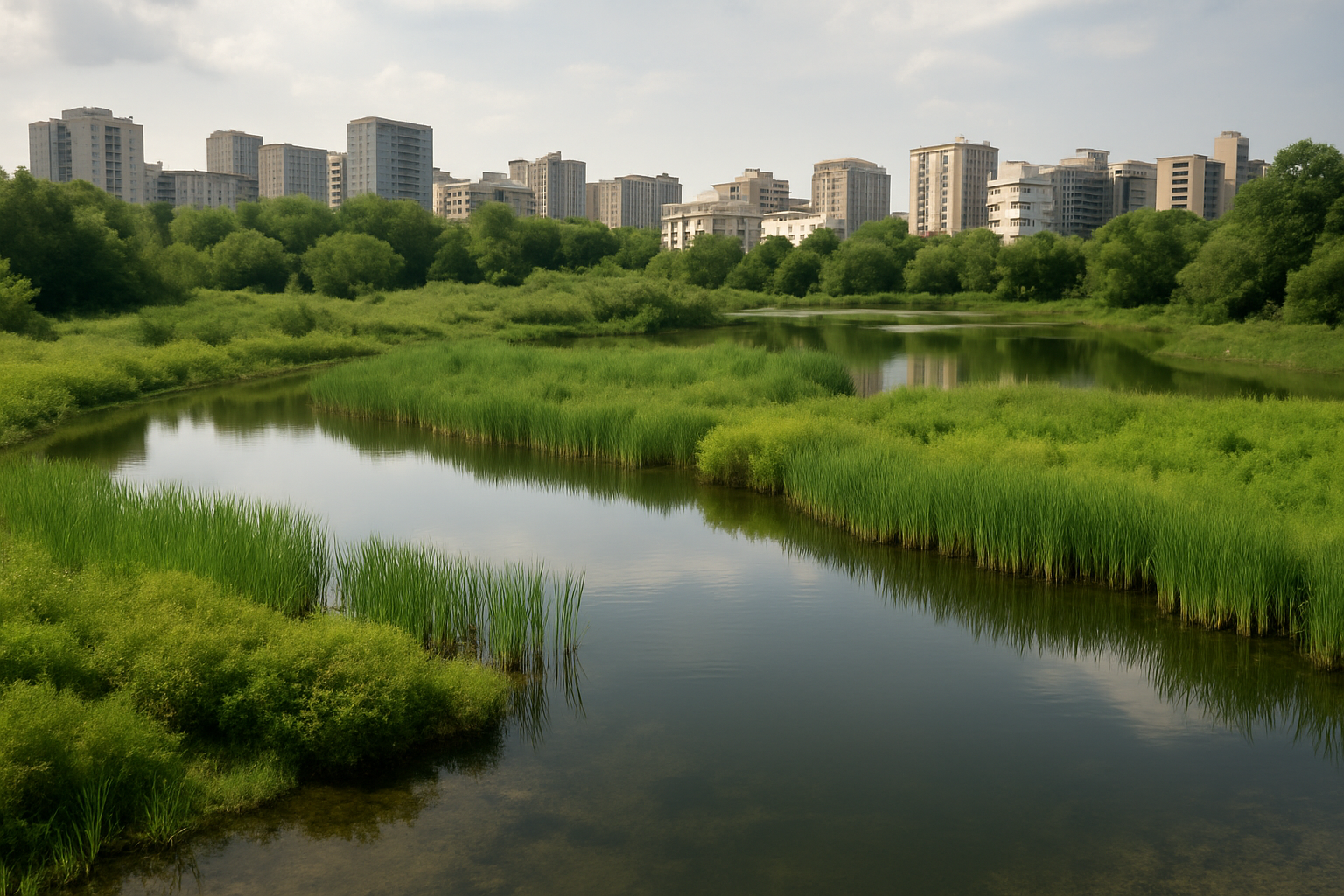
A new study conducted in Wuxi City, China, reveals that small and micro wetlands, often less than 8 hectares in size, play a disproportionately large role in maintaining urban ecological resilience, despite covering a relatively minor fraction of land. These small wetlands include seasonal ponds, artificial fishponds, montane marshes, and small lakes. Historically marginalized in both policy and land-use models, these ecosystems have now been identified as biodiversity hotspots, hydrological regulators, and pollution buffers.
The study, titled "The Underestimated Role of Small and Micro Wetlands in Enhancing Habitat Quality Amid a High-Intensity Anthropogenic Impact Area" and published in Water, systematically tracked land-use changes from 1980 to 2020 using Landsat remote sensing imagery and the Integrated Valuation of Ecosystem Services and Tradeoffs (InVEST) model. It developed two habitat quality scenarios, one with conventional land-use classifications and one with explicit inclusion of small wetland data. Comparing the two models allowed the researchers to isolate the impact of these wetlands on urban habitat quality across time and space.
Wuxi’s landscape transformation reflected intense urban pressure. Built-up land expanded from 8.68% to 28.40% of total area over four decades, primarily replacing cropland and disrupting local ecosystems. While overall habitat quality declined, with “poor” quality areas rising by 20 percentage points, the inclusion of small and micro wetlands reversed some of these trends, especially in central districts most affected by urban expansion.
How do small and micro wetlands enhance habitat quality?
The analysis found that the ecological benefits of small and micro wetlands far exceeded their spatial footprint. In 2000, these wetlands accounted for only 8.73% of the land area but contributed to a 12.30% increase in high-quality habitats when incorporated into the revised land-use model. The positive effect was particularly pronounced in high-density urban zones, such as Liangxi District, where “poor” habitats were upgraded to “fair” or “good” categories.
Temporal and spatial comparisons across the years 1980, 2000, 2010, and 2020 showed consistent patterns. Habitat upgrades linked to wetland inclusion peaked during rapid urbanization phases. For instance, between 2000 and 2010, Jiangyin City experienced a 6% increase in average habitat quality scores due to small wetland incorporation. Even limited gains in wetland coverage provided measurable improvements in ecosystem integrity across all zones, including more rural areas like Yixing.
In practical terms, these wetlands enhanced biodiversity by creating edge habitats, facilitated amphibian breeding through seasonal hydroperiods, improved flood mitigation through elevated evapotranspiration, and provided superior nitrogen-phosphorus filtration due to greater sediment-water interface contact. Their contributions extended to cultural and aesthetic ecosystem services, particularly in cities where green space is scarce.
Furthermore, spatial modeling confirmed that habitat degradation was strongly correlated with infrastructure expansion, particularly road and railway corridors. However, areas where wetlands were added to the model showed increased resistance to degradation, demonstrating their potential as ecological buffers even under high anthropogenic stress.
What does this mean for urban planning and conservation policy?
The findings highlight a serious omission in existing urban ecological assessment frameworks: the exclusion of small and micro wetlands from standard land-use datasets results in a systematic underestimation of their ecological value. This gap has real-world consequences for biodiversity conservation, flood risk management, and urban climate resilience.
Wuxi’s case exemplifies a broader challenge in fast-developing cities globally. While large wetlands often receive protection under environmental statutes, smaller ones, due to their fragmented nature and administrative invisibility, remain unaccounted for. Yet, the study proves that these small systems collectively outperform larger systems in many functions, including water purification and nitrogen load reduction.
Importantly, spatial differentiation in wetland effectiveness was evident. Central urban districts, where ecological pressure was highest, showed the greatest proportional gains in habitat quality from wetland inclusion. These findings suggest that small wetland conservation should be prioritized not only in ecological buffer zones but also in inner urban areas where their compensatory ecological functions are most valuable.
The authors recommend a three-pronged strategy: (1) designating small wetland clusters as high-priority conservation zones; (2) establishing dynamic, smart-monitoring platforms combining remote sensing and ground-based data; and (3) integrating small wetlands into sponge city frameworks and blue-green infrastructure to optimize multifunctional land use.
The modeling methodology itself offers a replicable template for other cities facing urban ecological degradation. By fusing satellite data, machine learning classification, and InVEST model simulations, cities can generate fine-grained assessments of their hidden ecological assets and make data-driven conservation decisions.
- FIRST PUBLISHED IN:
- Devdiscourse


